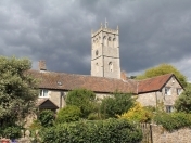


There is a lot of major development going on in and around Bleadon with dwellings planned on the Caravan Park, Purn Way and Devil's Bridge/Bleadon Hill. These and other developments are on the Parish Council agenda this Monday 10 July 17
http://www.bleadon.org.uk/media/other/24400/Agenda-297-July17.pdf
- 90 static and touring caravans at Purn Caravan /Riverside Holiday Park; outside the Settlement Boundary, that would make 310 in the immediate area. The 2011 Census said we only had 530 dwellings in the whole of Bleadon Parish! http://www.bleadon.org.uk/beinvolved.html?post_id=26290)
- 16 houses at Purn Way; outside the Settlement Boundary http://www.bleadon.org.uk/beinvolved.html?post_id=26242
- 70 new houses at Devil's Bridge; near the Parish Boundary http://www.bleadon.org.uk/beinvolved.html?post_id=26136
- Site adjacent to Bridge Road subject to Sites & Policies (SAP) Development Plan Examination; outside the Settlement Boundary questioning its designation as a Strategic Open Space http://www.bleadon.org.uk/majordevelopments.html#CoreStrategy
Weston General Hospital A&E services are now shut in the evenings, and, with the above developments, services can only become more pressured http://www.bleadon.org.uk/whatsnew.html?post_id=26262
Other more positive news includes:
- Resident Charles Reeves was interviewed by Radio Bristol re: local WW2 bombing http://www.bleadon.org.uk/events_blog.html?post_id=26232
- Lympsham Pre-School is now a feeder school for Lympsham C of E Academy, which in turn feeds to Hugh Sexey Middle school and Kings of Wessex http://www.bleadon.org.uk/whatsnew.html?post_id=26184
- Brean Down Way, the Weston to Brean Down cycle path, is now open http://www.bleadon.org.uk/events_blog.html?post_id=26135
- Bleadon WI are holding an afternoon tea and prosecco next Saturday, 15th July 3pm-5pm in The Coronation Hall, Bleadon. In aid of the Weston Hospital Scanner Appeal http://www.bleadon.org.uk/events_blog.html?post_id=26177
For other news and information in and around Bleadon see our news page at http://www.bleadon.org.uk/news.html
Make A Comment
Comments (4)
All the information we have is on this link http://www.bleadon.org.uk/parishplan.html so please have a look. However we never saw the final adopted 20 year plan either, only a copy of the 2008 draft and a leaflet of 103 Proposed Improvements which was sent to all residents. After 2009 the Parish Council seems to have lost the plan completely, and in April this year, four months after we asked for a copy, "The Clerk confirmed that the Parish Council cannot find a copy of the plan"?!
As regards the Sanders fields at Bridge/Bleadon Road, in 2011 residents voted against a development. The results are in the Bleadon Village News #89 - in the News & Views section, as seen on BOB here http://www.bleadon.org.uk/media/other/24400/bleadonvnsummer2011.pdf
The problem with increased services is that NSC may change our rural status of infill development, that will then bring extra housing outside of the settlement boundary, so It is a difficult balance.
Many years ago all residents in Bleadon were sent a form on which we could make suggestions about things we would like done to improve our village. This was called The Village Plan I seem to remember. When the Committee got the forms back, several villagers were arranged into teams to get things done. Well, I never saw anything come of this big scheme and my one suggestion was never mentioned. This was that we should have a Medical Centre attached to the village with maybe a Chemist attached to it. There was talk of land being available along Bleadon Road and a few houses as well being built and maybe a sports area with tennis courts. I think all this would go a long way to making our village a real Community. What happened to this big Village Plan?
The school is also related to an old NSC local plan that designated the fields a strategic open space, someone (possibly BPC) suggested a school could be built but as Sanders own the fields their price would be related development.
NSC Core Strategy and related Sites Allocation Plan is under review to identify where they will build 21,000 houses by 2026 and WSM area is taking most due to Green Belt protection between Bristol and Bath.
Sanders are querying the SOS designation so likely the survey is related. See this link and read hearing statements.
http://www.bleadon.org.uk/majordevelopments.html#CoreStrategy
Hope that helps and you can spread the word.
There were surveyors around for two days last week, measuring/surveying the Sanders fields beside Bridge Rd. Rumour has it for a school. Do you know what sort of school that would be and have you got any more info on that please?
Many thanks,