
UPDATE 23 July 2017 - BPC submit comment to NSC on this application

A new outline application for 16 dwellings has been submitted on Land off Purn Way (adjacent to West Mendip Way PROW and allotments), outside the Settlement Boundary.
Comments deadline has now been extended to 25 July 2017, according to the NSC website. Here is the link to the application 17/P/1351/O on North Somerset Council Planning website.
If you prefer to post your comments then the postal address is:
North Somerset CouncilDevelopment Management
Post Point 15
Town Hall
Weston-super-Mare
BS23 1UJ
If you do make comments on this BOB blog (below), please also make sure that they are made to, and appear on, the North Somerset website link as above. As otherwise they will be ignored by NSC.
---------------------------------------------------------------------
The following maps were created from the NSC GIS system which is a useful resource to see what policies and emerging proposals affect our land and environment in North Somerset.
Map 1 annotation indicates 'major' planning applications of recent years and the critical road junctions affected. It indicates how our rural area is threatened with environmental attack through traffic and light pollution; and why essential health services such as hospital/GP, dental appointments are so difficult to get. Apparently there is a central government formula that gives extra health service funding based on population, from our perspective this clearly isn't working as they are stretched already yet more houses and people are planned! See related Weston Hospital A&E Services Reduced Blog and table of major developments in and around Bleadon.

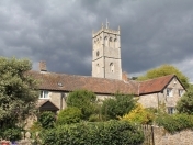
Map 2, with annotation, is an image of Bleadon Parish Boundary showing the Settlement Boundary. Note 2011 Census recorded 530 dwellings in Bleadon, so clearly these additional development applications will make a significant difference to our environment, health and wellbeing when built.

Map 3, with annotation, is an image of Bleadon Settlement Boundary.
Bleadon appears in NSC 'Core Strategy' section CS33 as a designated 'infill' village and below shows the Settlement Boundary beyond which any development is supposedly more tightly controlled on criteria specified by the National Policy Framework (NPPF) and NSC Core Strategy policies. Bleadon's 20 year Parish Plan was formulated in 2005, adopted in 2009 and sent to NSC to feed into the NSC Replacement Local Plan process. (Folllowing the Localism Act 2011 it is now known as the 'Core Strategy'). Unfortunately despite costing thousands of pounds it can't be found by either BPC or NSC, although BOB still has a draft 2008 copy along with the Questionnaire data and background information here. The Localism 2011 Act introduced Neighbourhood Plans and now (if produced) they specify where local housing and economic development is desired. However, BOB and others (see CPRE) still believe that our Parish Plan Data and 103 Actions should still play an essential, valuable and central role in routinely steering the holistic direction of BPC resource allocation in performing their duties/powers and decision making, including what applications to 'grant' or 'refuse'. See additional Settlement Boundary information on the Major Development page on BOB.

Mapping indicating the Public Right of Way and proximity to Sites of Nature Conservation Interest (SNCI)

For some background as to why developers continue to pressure NSC Planning please see the associated policies/documentation and Green Belt mapping on the Major Development page and associated table of information on BOB.
Make A Comment
Comments (1)
---------------------------
Firstly and fundamentally, Bleadon is a NSC (CS33) designated Infill Village and this application site is outside of the long established Settlement Boundary, so surely this application must be rejected as otherwise what is the point of the designation and the Core Strategy Local Plan Policy which involved extensive consultation and costly production. Also the 20 year Bleadon Parish Plan that was previously adopted by BPC in 2009 states it will "Through the Planning process vigorously question all development outside the Village Settlement" and "Ensure that all new development is within the village Settlement Boundary". Also NSC Corporate Plan stating they need to "promote growth without compromising the things that we, and our millions of visitors, love about North Somerset: our beautiful countryside, stunning coast and distinctive towns and villages, each with their own unique character."
This application is on a greenfield site not a Brownfield Site, it has not been previously identified as suitable for development under the Site Allocations Plan consultation. This will not be 100% affordable housing (CS17) in a sustainable location and is clearly speculative over development and given the existing road infrastructure, an accident (or more) waiting to happen. What about access for water, electric, gas, communication services and foul waste disposal too? Existing residents report that these would all not have capacity for this development. Public transport timetable will not be suitable to get to work or school before 9am meaning cars will be necessary, also to access the various other public and health services not in Bleadon.
There is a public right of way (which is part of the West Mendip Way) adjacent to this field. The views and natural habitat for wildlife over the surrounding landscape from this and surrounding roads will clearly also be permanently affected during construction and when completed and also consideration to hedgerow regulations should be given to protect the various wildlife habitat provided by them.
So why do the greenfields 'of beautiful countryside' that surround the village, that are key to Bleadon's 'unique character' need to be built on? Is the intention to 'gradually grow' Bleadon into a suburb of WSM with all greenfields being eventually built on and Bleadon village and surrounding greenfield parish destroyed?
This is just one of many current applications within the surrounding area and almost all are outside our long established Bleadon settlement boundary. The accumulated effect of all these applications on the rural Bleadon community and environmental landscape needs to be considered as a holistic whole and not individually.
We believe NSC needs to take a firm stand against all of these speculative applications and protect its own well considered and consulted planning policies. Otherwise what is the point of their existence leaving the property development industry to build whenever, whererever and whatever they please with the Planning Inspectors permission with no accounting for the health and well-being of the existing community residents they will and currently do affect!